Categories
Opinion Transportation

Opinion: A Boulevard for Brent Spence Bridge Exit

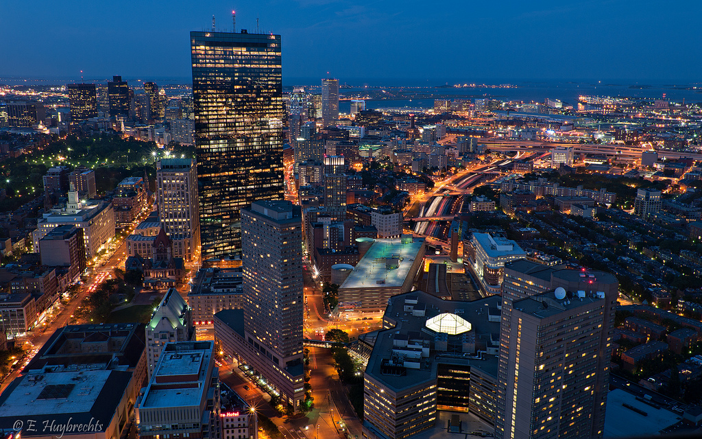
Covington is in the midst of a redevelopment wave. A number of prominent historic buildings have recently been rehabbed and several large new mixed-use buildings are in the planning stages or under construction.

Two of the new projects, “Riverhaus” at 501 Main Street, and the John R. Green Lofts at 411 West 6th Street are scheduled to bring 369 new apartments into the Main Strasse neighborhood.  Census tract 603 covers most of the Main Strasse neighborhood and it shows 1,491 residents living there in 2015. Those two new projects will add a significant increase in the local residential population density.  Their ongoing progress reflects the demand for residential development in pedestrian-friendly urban spaces.

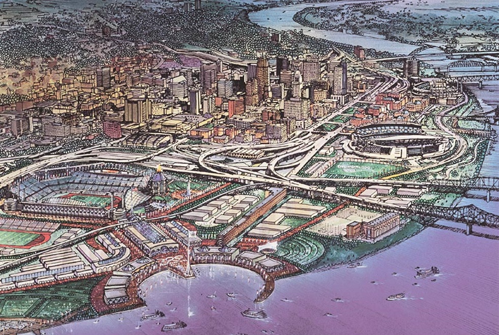
Part of Covington’s urban core that hasn’t seen any new residential development is the area north of 4th street between Madison Ave. and I-75.  Dubbed “Hamburger Heaven” in the city’s recent City Center Action plan, it contains multiple fast food restaurants, the sprawling one-story IRS center, and a sea of parking lots. Part of the reason the area hasn’t seen any development is that Covington’s 4th Street delivers 27,000+ cars per day to I-75. That much traffic is incompatible with pedestrian-friendly urban space.  

The City Center Action Plan makes redevelopment of the Hamburger Heaven and IRS sites a priority but it does not address the area’s inhospitable traffic. It’s a problem: How do you connect new development north of 4th street to the existing pedestrian-friendly urban fabric while maintaining all the traffic to the interstate?

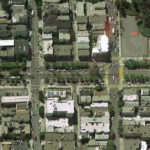
The imminent closure of the IRS site presents an opportunity to address the problem. The 23-acre site covers 3-1/2 blocks of frontage on 4th street. Most of the remaining space adjacent to 4th street between the IRS site and I-75 consists of parking lots.

Once the IRS site is closed, the city of Covington should widen 4th street and convert it into a multiway boulevard.

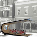
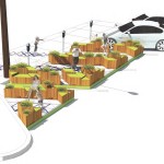
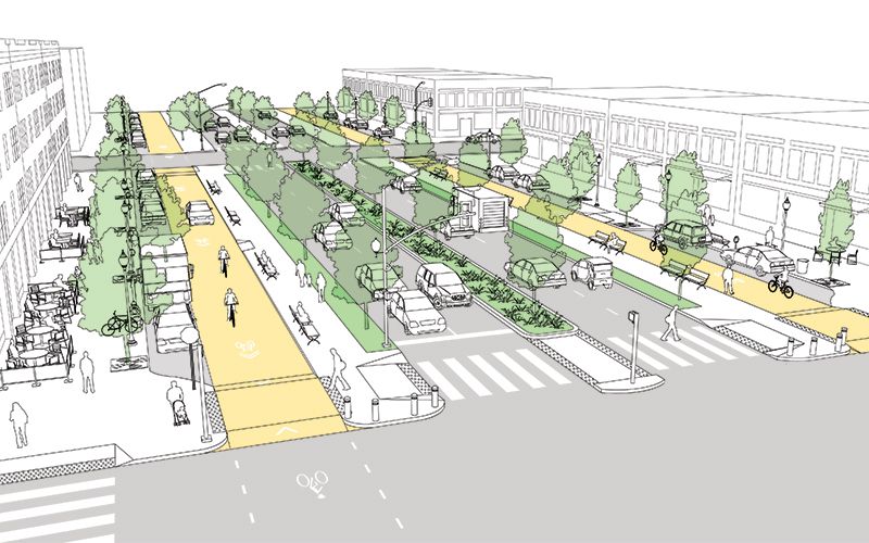
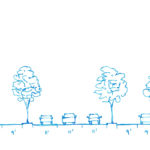
A multiway boulevard consists of a series of central lanes to move through-traffic, side lanes with on-street parking to serve local vehicles and bicycles, and broad sidewalks to serve pedestrians. Tree-lined medians separate the local traffic from through-traffic, and trees on the sidewalk further separate pedestrians from traffic. Think of it as a “mixed-use street.” Because the street supports a different mix of uses – people, bicycles, transit, through traffic – it can more readily support mixed-use buildings at its edges. Mixed-use buildings add the density and diversity of uses that support pedestrian-friendly urban space.

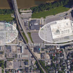
San Francisco recently took an existing street and converted a portion of it into a new multiway boulevard. The creation of Octavia Boulevard was possible because an earthquake damaged a freeway and made it unusable. Instead of rebuilding the freeway, San Francisco added its right-of-way to a four-block stretch of Octavia Street, which became Octavia Boulevard.

Today, Octavia Boulevard moves 45,000 cars per day in two directions, it has side streets and broad sidewalks to serve local residents, and the creation of the street spurred new development on its edges. Octavia Boulevard sets a clear precedent for converting underutilized auto-oriented development into more productive mixed-use urban development. Octavia Boulevard is aesthetically pleasing, practical at moving traffic, and successful at promoting economic development.

To implement Covington’s “4th Street Boulevard Project” the street’s existing 50-foot right-of-way would be widened to the north to create a 100+ foot wide right-of-way.

The expanded right-of-way will accommodate the multiway boulevard’s additional lanes, medians, and sidewalks. Expanding the right-of-way will require part of the IRS parcel, a number of parking lots, and the demolition of a fast food chain restaurant.

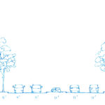
Different design options could include making 4th street’s through lanes either one-way or two-way. A dedicated transit lane could be accommodated. Bicycles can share the local lanes with local vehicular traffic.  

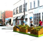
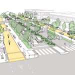
Implementing the 4th Street Boulevard Project would have multiple effects that support the ongoing urban renaissance. The medians and parked cars provide protection for people to walk, eat, drink, and socialize outside. Trees also protect pedestrians and provide a canopy for shade and cooling. Bicycle use will be safe and easy. Converting 4th street from a single use – channeling cars to I-75 – into a multiway boulevard will facilitate the development of dense mixed-use buildings.

There’s a historic opportunity here. The IRS site was born out of federal urban renewal projects in the 1950s. Its time is now at an end.  The trend of the future is to live, work, and play in the urban core. The current traffic on 4th street is a barrier to urban development. Converting 4th street into a multi-way boulevard will support the traffic flow but mitigate its negative impacts. Recent examples provide good evidence.

If the ongoing urban development is to be sustained and space north of 4th street – just blocks away from the Ohio River – is to be put to its highest and best use, then the traffic along 4th street must be addressed. Converting 4th street into a multiway boulevard will do just that.


This is a guest editorial by Chris Meyer that originally appeared in the CNU Midwest blog. CNU and CNU Midwest are content partners with UrbanCincy.

If you would like to have your thoughts and opinions published on UrbanCincy, simply contact us at editors@urbancincy.com.
Categories
Arts & Entertainment Business News Transportation

Covington Embraces Idea of Transforming On-Street Parking Into Public Spaces

Five sites and designs were recently selected for bringing parklets to the heart of Covington. The announcement came on Friday, January 15 and marked the conclusion of a design-build competition called Curb’d.

Organizers say that the intent of the competition was to support Covington’s business districts by promoting walkability, connectivity and placemaking – topics that align with the Haile/U.S. Bank Foundation, Renaissance Covington and MainStrasse Village Association, which provided financial support for the competition.

The five selected sites are also seen as a pathway link between the MainStrasse and Renaissance districts in Covington’s downtown.

First popularized in North America in San Francisco, parklets have grown in popularity over the years particularly in neighborhood business districts looking to reclaim public space from cars for people walking, biking, shopping or simply relaxing. Over the years, cities, like Chicago, have even embraced the idea so much that specific design guidelines and practices have been institutionalized to lend legitimacy to the movement.

In Cincinnati that has so far not been the case.

In 2012, a parklet program was proposed for Over-the-Rhine, but the effort never gained the community support, funding and endorsement from City Hall that it would ultimately require. Since that time, ideas have been pitched to develop a parklet in front of Tucker’s Restaurant on Vine Street, but those efforts have also fallen short.

Aside from that, the closest the region has come to experiencing the transformation of on-street parking spaces into other uses has come in the form of the international celebration of PARK(ing) Day.

While parklets have generally become known as public seating areas or small parks, the organizers of Curb’d said they wanted to push the limits with this competition.

“The examples that we showed the businesses and designers in our information sessions were glow-in-the-dark swings, a mini-movie theater, and a bus stop that resembled an old school radio,” explained Sam O’Connor, Curb’d project coordinator. “Ultimately, we wanted our design teams to really discover the potential of a parking space.”

After finding businesses interested in participating, O’Connor says they, in cooperation with the participating businesses, then proceeded to curate a collection of 12 design teams that would come up with proposals for the spaces. The selected design teams then worked with local fabrication workshops to discuss their ideas and work through the logistics of turning their designs into reality.

After some further refinement, five design teams had their proposals selected to receive funding to have them built.

A+D Design developed what they called Hopscotch Garden for space in front of Braxton Brewing on W. Seventh Street, and will work with 3dx on fabrication. The concept calls for a space that will allow for people to sit and enjoy a beer or coffee outside, while also offering a hopscotch zone.

BPHOGS Design came up with The Boxing Ring for a location in front of Cutman Barbershop and Flow. They will work with Weld Rite Industries to produce the parklet, which will include passive spaces for seating and dining. The parklet will also include several programmed spaces, which, fittingly enough, will include speed bags positioned along the sidewalk to allow for maximum accessibility, and a center area for a game of Rock ‘Em Sock ‘Em.

Hub+Weber Architects designed a parklet intended for people to exercise and enjoy virtual trips to far away destinations, or even classic movies shown on a projector powered by the pedaling of the bikes. The stationary bicycle space will be located in front of Inspirado at Madison Gallery.

In front of Left Bank Coffeehouse, Seth Trance and Harry Ross developed a concept they call Wish-Igloo, which they hope will promote engagement between the first person who uses the parklet and the last person who does so. Trance and Ross believe this will be accomplished through the parklet’s striking design that is both changeable and invites users to physically manipulate the space.

The final project is also, perhaps, the most unique. To be located next to Stoney’s Village Toy Shoppe, John Noble & Team came up with a design that includes a range of engaging toys for children of varying ages. In essence, the parklet is seen as a way to extend the shop’s culture out onto the street, while also encouraging children to be more active.

Fabrication of each of the five parklets is expected to begin within the next week or so, with installation taking place the first week of May. O’Connor says they plan to do a grand reveal on Friday, May 6, with the parklets staying in place until the end of October when they will then be taken down.

EDITORIAL NOTE: An earlier version of this story incorrectly stated that MSA Architects designed ‘The Boxing Ring’ parklet for in front of Cutman Barbershop. That parklet design was actually produced by BPHOGS Design. Additionally, due to a mix-up in winning project announcements, it was incorrectly stated that Hub+Weber Architects designed the coloring lounge concept for in front of Madison Gallery. Hub+Weber Architects actually designed a stationary bicycle parklet. Both items have been corrected in this story.

Categories
Up To Speed

With many cities no longer interested in hosting mega events, what’s the future for the Olympics and World Cup?

With many cities no longer interested in hosting mega events, what’s the future for the Olympics and World Cup?.

Cincinnati make an unlikely bid for the 2012 Summer Olympics. The Queen City lost out to a number of other American cities that became the finalists for the U.S. selection, which ultimately put New York City in the running against a host of global competitors. Those days of heated competition to host the games, however, may be over. More from CityLab:

If the U.S. bid had gone to D.C., San Francisco, or Los Angeles, critics would have rallied against the Games in those cities the same way they did in Boston. Support for the Games was bound to fall in the wake of an actual bid, as critics sought to expose the high costs or unpractical plans that usually attach themselves to these mega-events.

I don’t see how a U.S. city will ever again host the Olympic Games. Or a World Cup, for that matter. (We’re stuck with the Super Bowl, though.) While mega-events could help cities in Western nation accomplish good things, the participation of authoritarian states is driving the Olympics and the World Cup toward extreme costs and extravagance.

Categories
Development News

Columbus is not the biggest city in Ohio, and Indy’s not bigger than Boston

Following the release of the U.S. Census Bureau’s updated population numbers for American cities, much has been made about the urban rise of the west. Even the Census Bureau itself touted the growing number of cities with more than 1 million people – the vast majority of which are located west of the Mississippi River.

These numbers can be misleading, and often don’t even pass the smell test.

Is Jacksonville, for example, really a bigger city than Detroit, Washington DC, Atlanta and Boston? Or out west, would most people actually consider Phoenix to be a larger city than San Francisco, Seattle, Denver or San Diego? Of course not.

In both scenarios, however, that is precisely the case. That is because the municipal boundaries for Jacksonville (885 square miles) and Phoenix (517 square miles) are disproportionately large compared to the population of their city. Closer to home the same is true for Columbus (223 square miles), Indianapolis (368 square miles) and Charlotte (298 square miles) – all of which skew the average population density for cities east of the Mississippi downward due to their huge municipal footprints.

If you were to simply pick-up a daily newspaper and read the listing of America’s most populated cities, you would not get this full perspective and perhaps be misled to think that Columbus is the biggest city in Ohio, or that Indianapolis is the fifth largest city east of the Mississippi River.

Using this same practice, some might consider Cincinnati to be a small city that doesn’t even crack the top 30 in the United States.

Of course, we know all of this is skewed by all sorts of factors. Some cities sit on state or county lines, others follow historical boundaries from hundreds of years ago that have never changed, while other are granted more liberal annexation capabilities. In short, it’s politics.

Now if we were to look at America’s 30 most populous cities again, but rank them by population density instead of overall population, the picture would change rather dramatically. Most cities in the west fall considerably, while older cities in the east would rise. The outliers that have artificially inflated their boundaries over the years also fall into a more normalized position on the chart.

While Cincinnati is not in the top 30 in terms of population, we considered it anyways since this is UrbanCincy after all. After adjusting for population density, Cincinnati would vault all the way to the 16th “biggest” city in America, just behind Denver and ahead of Dallas. This is also more in line with Cincinnati’s metropolitan population ranking that falls within the top 30 in America.

Those cities in this analysis that are in the east have an average population density, outliers included, of 6,579 people per square mile, while those in the west, come in at 3,804 people per square mile.

If outliers like Jacksonville actually were as large as they project, and followed the average population density for the region, it would need to add close to 5 million people. Likewise, Indianapolis would need to add around 1.6 million people and Charlotte 1.1 million. Local politics and market conditions in each of these cities will never allow for this many new people to move within city limits.

The Washington Post is correct in that the west is getting more populated and urbanizing at a fast pace, but let’s not get ahead of ourselves. The most populated cities in the west would only be average, at best, in the east if they were judged by population density instead.

Now, factoring for population-weighted density would be an entirely different ballgame.

Categories
Up To Speed

Should Cincinnati look to Chicago’s new ARO for affordable housing guidance?

Should Cincinnati look to Chicago’s new ARO for affordable housing guidance?.

Cincinnati has experienced rising property values in a handful Census tracts in recent years, while dozens remain below median values for the region. So unlike New York or San Francisco, the gentrification taking place in Cincinnati is not what typically comes to mind when the topic is discussed. A more apt comparison may be Chicago where a more extreme version of rising property values stand in contrast to swaths of the city that remain mired in poverty, and new policies are moving forward to address the matter. More from NextCity:

The new ARO would require that at least 25 percent of affordable units be built on site, removing the ability to opt out totally. City neighborhoods would be classified into “downtown,” “high-income” and “low-moderate income,” and the in-lieu fee for the remaining 75 percent of units, if a developer chooses that option, would rise to $175,000 downtown and $125,000 in high-income areas; it would fall to $50,000 in the rest of the city. Developers would also be allowed to meet the affordable unit requirement by building or rehabbing on other lots within a mile of the main site. The aim is to create affordable units in the neighborhoods where they’re most scarce, rather than to continue to concentrate them in the city’s poorer communities.

That goal reflects what makes Chicago’s affordable housing crisis different than the ones in a handful of coastal cities that have dominated national coverage. In many Chicago neighborhoods, depopulation, disinvestment, segregation and crime have kept housing values relatively low, even just a few miles from the booming downtown. Meanwhile, communities on the North Side — as well as a handful to the south and west of the Loop — have seen rapid gentrification and skyrocketing rents. That dynamic has led to a dramatic increase in economic segregation.